|
IDAHO COUNTY MAPS OF INTEREST |
|
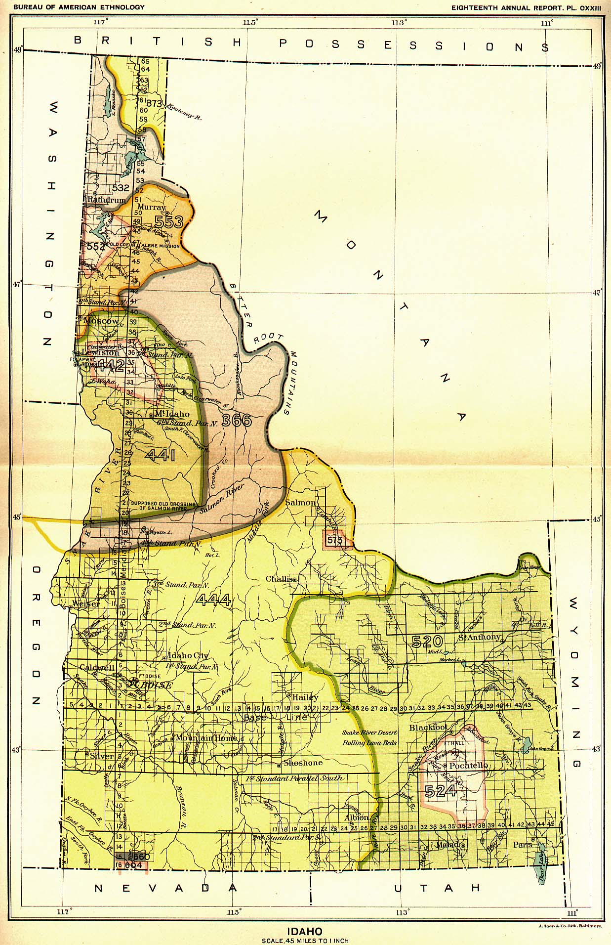
Indian Land Cessions Map |
|
|
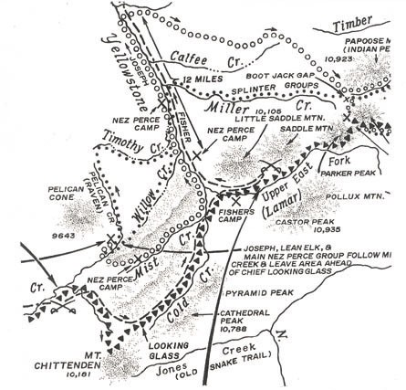
Nez Perce War Map |
|
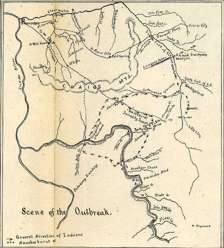
| Indian Outbreak Map |
|
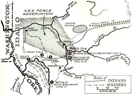
| Route of Indians & Soldiers |
|
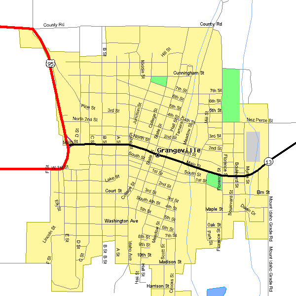
| Grangeville City Map |
|
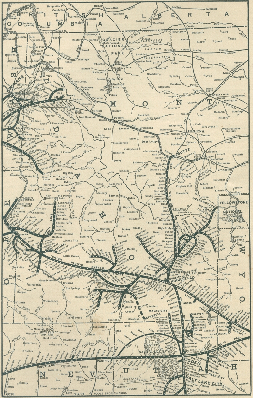
| Railroad Map |
|
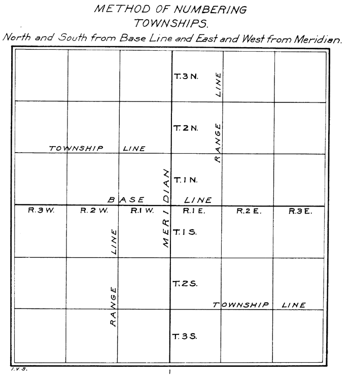
| Method of Numbering Township/Range |
|